Key Issues
- Determine Site suitability for managed groundwater recharge
- Define pond/creek/groundwater interaction
- Complete study within tight schedule under difficult conditions
Solutions
- Plan, collect and analyze key relevant data to support study findings
- Prepare a water balance of the ponds under different creek route alternatives
- Provide flexible and responsive field planning and implementation
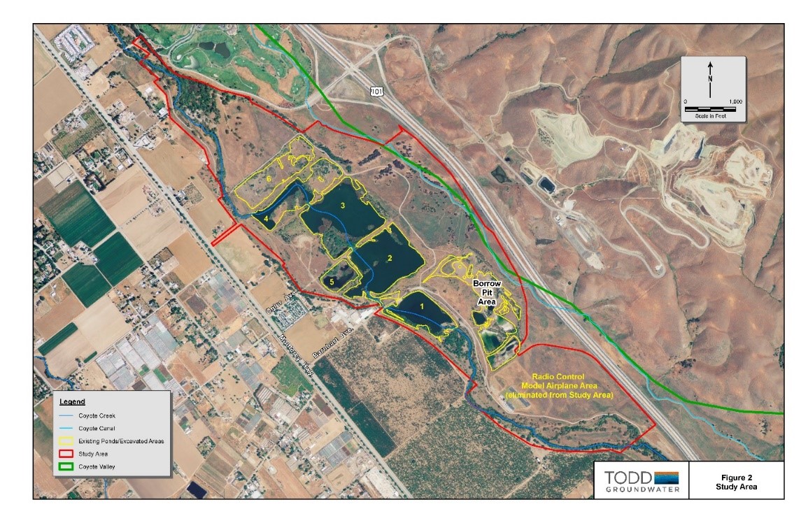
Ogier Ponds Groundwater Recharge Feasibility Study
Santa Clara County, California
Santa Clara Valley Water District (District) retained Todd Groundwater to assess the feasibility of stormwater capture and groundwater recharge on the Ogier Ponds site (Site) in the Coyote Valley area of the Santa Clara Subbasin. The Site is part of the Coyote Creek Parkway recreation area operated by Santa Clara County Parks and Recreation Department. Historically, the Site was a gravel mine. Several gravel and borrow pits were excavated to various depths at the Site over the period of active mining. Several of the excavations filled with water forming ponds during active mining. Coyote Creek historically flowed around the pits, but was diverted into the ponds after a levee breach in the 1980s.
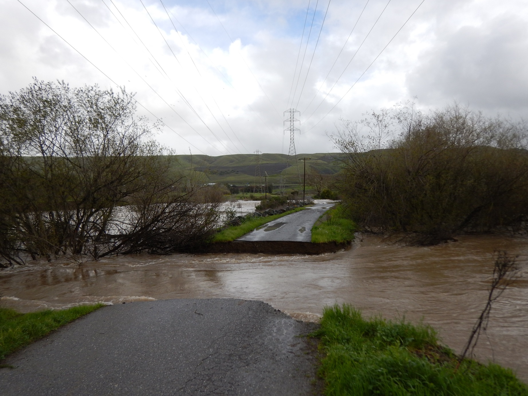
Field investigations were conducted to assess the recharge potential of the Site including vadose zone characteristics, depth to groundwater and the interaction between surface water and groundwater. Field work included surface geophysical surveys, monitoring well installation and monitoring, and pond height and stream flow gaging. The study had a tight schedule and was challenged with difficult field conditions during the winter of 2016/2017, which saw near-record rainfall in northern California. As the result of high creek flows during this period, flooding occurred at the Site, the main Site access road was breached, and some field monitoring equipment was submerged and damaged.
While vadose zone materials are relatively coarse-grained and suitable for managed recharge, groundwater was measured close to the ground surface limiting the storage capacity beneath the Site. Hydrogeologic cross sections prepared for the study showed a continuous water surface and direct hydraulic communication between shallow groundwater and water in the ponds. As a result, surface water spread on Site for recharge purposes would likely discharge to the ponds rather than recharge the groundwater system; therefore, the Site was deemed not suitable for stormwater capture and groundwater recharge.
The managed groundwater recharge feasibility study was one component of a larger study, which also evaluated flood attenuation, creek restoration and habitat improvements and recreational uses. Review of historical aerial photographs, stream flow data, precipitation records, and other Site water level data showed that the height and extent of water in the ponds varies according to Coyote Creek flows and associated fluctuations in the shallow groundwater table. The volume of creek flow necessary to maintain the ponds was estimated. The feasibility study concluded that Coyote Creek could be rerouted outside the ponds with little effect on the volume of water in the ponds and their recreational uses.